The Esplanades
During
1899
Alfred
Fidler
the
Borough
Surveyor
had
prepared
an
ambitious
scheme
for
a
continuous
seawall
and
esplanade
from
the
Halfway
House
in
the
east
to
Chalkwell
in
the
west.
The
works,
some
of
the
largest
ever
to
have
been
under
taken
in
the
Borough
would need to overcome a few hurdles before work could start.

Southend Timeline Southend-on-Sea © 2009 - 2024. All Rights Reserved

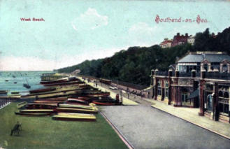
Southend-on-Sea
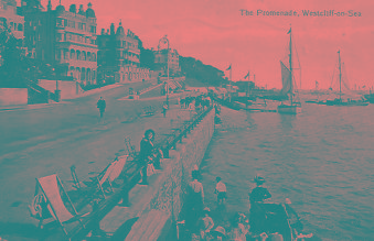
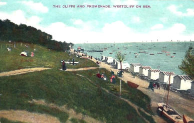
Westcliff Esplanade
Grosvenor Road to the Piccadilly Steps (Holland Road)
The
Westcliff
section
stretched
from
Grosvenor
Road
to
the
Piccadilly
Steps
below
Holland
Road,
this
section
was
also
known
as
the
Leas,
in
recent
years
it
has
merged
with
Western
Esplanade.
In
August
1901
the
final
plans
included
a
seawall
backfilled
with
rubble
and
soil,
the
rubble
was
brought
down
to
Southend
by
Thames
Barges
from
London,
once
the
infilling
was
complete
it
was
proposed
that
the
reclaimed
land
would
be
levelled
off
so
that
a
road
up
to
70ft
wide
and
a
footpath
could
be
laid
for
immediate
use.
Work
started
in
May
1903,
and
completed
in
March
1905
at
a
cost
of
£12520.
Both
the
Chalkwell
and
Westcliff
sections
were
treated
to
a
ceremonial
opening
by
the
Mayor
Alderman
Arthur
Loury
on
2nd
October
1905,
a
temporary
gate
for
the
opening
procession
to
pass
through,
was
erected
at
the
foot
of
Grosvenor
Road.
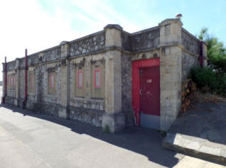
A
public
toilet
block
was
built,
over
time
these
fell
in
to
a
state
of
disrepair.
The
building
was
eventually
offered
for
lease,
conversion
to
a
café
or
restaurant
with
a
stipulation
that
some
form
of
public
toilets
were
kept.
The
lease
was
signed
and
saw
the
site
become
the
popular
Toulouse
Restaurant,
with
public
toilets
at
one
end,
the
toilets
are open during the summer season only.
Over
the
years
the
seawall
has
been
maintained,
the
footpath
and
road
resurfaced
several
times,
a
survivor
from
the
day
is
the
original
railings
that
top
the
seawall,
the
stretch
from
the
old
Westcliff
Jetty
to
the
first
bastion
remains.
The
railing
originally
stretched
from
the
bastion
to
Chalkwell.
This
section
marks
the
position where the Westcliff Jetty was located.
Western
Esplanade
is
lined
by
Palm
Trees
adding
a
Continental
feel,
the
first
twelve
went
in
during
April
2010
in
total
100
line
the
seafront,
the
majority
are
to
be
found
on
Western Esplanade.
In
2010
there
was
a
complete
repainting
of
the
Western
Esplanade
parking
bays,
however,
the
changes
did
not
go
quite
according
to
plan...They
were
originally
at
90
degrees
to
the
road,
the
parking
bays
were
repainted
so
that
they
faced
the
oncoming
traffic,
cars
approaching
an
empty
bay
could
pull
straight
in,
this
resulted
in
complaints
that
all
cars
would
have
to
reverse
out
into
the
flow
of
traffic
increasing
the
risk
of
accidents.
The
bays
were
repainted
within
a
few
months
so
that
they
faced
away
from
the
oncoming
cars,
drivers
would
pass
the
bay
they
wanted
and
then
reverse
in
so
that
they
could
just
pull
forward
to
leave
the
bay,
again
people
complained
that
if
a
car
was
parked
alongside
they
could
not
see
past
it
to
enable
them
to
pull
out
into
the
flow
of
traffic.
The
method
of
reversing
into
a
parking
bay
fully
conforms
to
Department
of
Transport guidelines.
There
have
been
seawater
pools
dotted
along
the
seafront
from
Leigh-on-Sea
to
Shoebury
since
the
esplanades
were
built,
some
of
these
are
still
in
use
and
have
been
maintained
and
rebuilt
new
ones
have
popped
up
whilst
others
have
been
demolished.
2015
saw
a
major
new
seawater
lagoon
built
on
Western
Esplanade
costing
£850,000
it
featured
a
120-metre
wall,
with
up
to
three
metres
above
sea
level
built
from
sheet
piles,
rock-filled
baskets
and
boulders,
the
incoming
tide
would
top
over
the
wall
refreshing
the
captured
water,
giving
children
a
safe
place
to
paddle
or
swim
even
when
the tide is out. The chosen site was immediately outside the Three Shells café.
At
the
eastern
end
of
Western
Esplanade
is
the
Pier,
along
the
side
of
the
Pier
is
Adventure
Island
(formerly
Peter
Pans
Playground
and
before
that
the
Sunken
Garden), opposite is Pier Hill, all have seen many changes over the years.
Marine Parade
The Pier to Southchurch Avenue (The Kursaal)
Marine
Parade
on
the
Eastern
side
of
the
Pier
was
not
widened
until
1931,
this
side
developed
in
to
the
boating
lake
and
Mr
Thompsons
Railway,
after
over
a
decade
of
dereliction
it
was
connected
to
Adventure
Island
via
a
tunnel
under
the
Pier
to
become
part of Adventure Island.
Eastern Esplanade
Southchurch Avenue (The Kursaal) to Halfway House (built 1870)
Part
of
the
Eastern
Esplanade
was
widened
between
1899-1901
the
wider
promenade
ran
along
to
Bryant
Avenue.
It
was
proposed
in
February
1902
that
further
works
to
extend
the
wider
promenade
to
the
Halfway
House
should
be
put
on
hold
so
that
all
efforts
could
be
concentrated
on
the
works
on
the
Western
side
of
the
Pier.
In
April
1908
it
was
decided
that
the
tram
network
needed
to
be
extended
from
its
then
terminus
at
Minerva
Public
House
to
the
Halfway
House.
The
works
to
extend
the
tramway
system
could
only
go-ahead
if
the
promenade
was
widened
so
work
commenced
in
July
1908,
costing
£5700,
the
works
did
not
include
a
seawall
protruding
above
the
level
of
the
footpath.
The
ground
works
were
completed
by
the
autumn
of
1909,
with
the
tramway
extension
being
opened
to
the
public
on
16th
November 1900.
A
further
widening
of
Western
Esplanade
took
place
in
1925,
with
the
construction
of
the
Marine
Gardens
alongside
the
Western
side
of
the
Pier,
the
site
would
develop
into
Peter
Pans
Playground/Adventure
Island.
During
the
widening
a
public
toilet
block
was
included
at
Darlows
Green,
these
toilets
still
remain
but
have
been
closed
for since the mid 1990s.
Eastern
Esplanade
did
not
have
a
sea
wall
above
the
height
of
the
footpath,
by
1939
the
dark
clouds
of
war
were
gathering
on
the
horizon
as
they
grew
darker
Southend’s
beaches
became
no
go
areas
with
access
to
the
esplanades
restricted.
The
War
Office
had
seen
how
flat
the
Southend
foreshore
was,
the
gentle
slope
to
the
beach
leading
up
to
a
sloping
seawall
and
then
on
to
the
footpath
and
onto
the
road,
with
many
roads
coming
off
leading
to
the
heart
of
Southend,
this
would
have
offered
any
invading
force
an
easy
way
to
encroach
deep
in
land,
setting
up
a
beach
head
for
further
landing.
To
slow
any
attack
1804
concrete
anti-tank
blocks
were
erected
the
entire
length
of
the
seafront
on
the
edge
of
the
esplanade,
they
had
barbed
wire
strung
between
them
with
a
few
left
open
to
enable
access,
the
beach
itself
was
lined
with
scaffolding intertwined with more barbed wire.
Once
war
was
over
the
scaffold
and
barbed
wire
was
removed
from
the
beach
whilst
all
but
two
concrete
blocks
were
demolished
and
the
esplanade
was
restored
to
its
pre-war
condition,
however,
just
a
few
years
later
this
would
leave
a
lasting
legacy
of
sorrow.
On
the
night
of
31st
January
1953,
there
was
a
Spring
tide
in
the
North
Sea,
this
coupled
with
a
deep
Atlantic
depression
passing
just
north
of
Scotland
took
a
sudden
south-east
into
the
North
Sea.
This
coincided
with
a
northerly
gale
on
the
western
side
of
the
depression,
these
combined
forced
large
quantities
of
water
south.
To
make
matters
worse
the
storm
was
reaching
its
peak
at
the
same
time
as
high
tide
was
due,
at
all
the
towns
all
along
the
east
coast
of
England,
this
caused
a
storm
surge
some
5.6meters
(18ft)
above
normal
sea
levels.
Southend
saw
flooding
at
the
Kursaal,
Gasworks,
Esplanades
and
roads
adjoining
the
seafront,
other
towns
suffered
much
worse
with
59
people
killed
at
Canvey.
A
raised
seawall
was
erected
soon
after
the
floods running from the sunken gardens on Marine Parade to Thorpe Bay Corner.
Like
any
beach
Southend
suffers
from
long-shore
drift,
the
groynes
act
as
a
barrier
to
slow
the
drift
of
the
sand
but
over
time
the
sand
will
still
be
washed
from
the
beaches.
With
the
level
of
sand
falling
the
foundations
of
the
seawall
were
slowly
being
exposed.
To
help
boost
the
towns
flood
defences
the
entire
beach
from
Adventure
Island
to
Lynton
Road,
Thorpe
Bay
was
replenished,
A
dredger
would
suck
the
sand
up
from
the
estuary
and
pump
it
ashore
through
a
pipe
up
to
two
miles
long,
the
sand/water
mix,
the
sand
being
heavier
would
remain
on
the
beach
whilst
the
water
would
run
away.
Much
of
the
sand
was
pumped
ashore
from
the
sandbanks
that
are
dotted
around
the
Thames
Estuary.
The
cost
of
the
scheme
was
£6
million
of
which
£2.6
million
was
paid
for
by
a
Central
Government
grant.
Work
started
in
October
2001
on
repairing
sections
of
the
seawall
that
had
been
damaged
also
improved
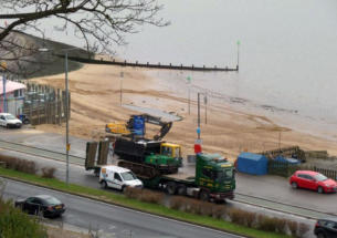
slipways were constructed for the launching of yachts.
An
extensive
study
lasting
over
a
year
in
to
the
wildlife
habitats
helped
designers
design
the
lay
of
the
new
beach.
The
Marine
Parade
section
was
to
become
known
as
City
Beach.
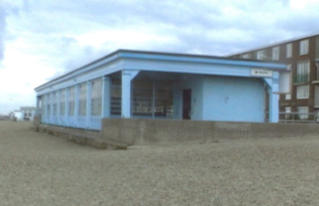
A
large
public
sun
shelter
was
built
on
Eastern
Esplanade,
it
featured
a
large
glazed
frontage
overlooking
the
sea
with
public
toilets
below.
As
the
draw
of
British
seaside
holidays
declined
the
shelter
was
used
less
and
less
by
holiday
makers,
many
of
the
windows
became
broken
and
homeless
used
it
to
bed
down
at
night,
with
the
cost
of
maintenance
increasing
the
council
locked
it
up
and
offered
it
on
a
lease
as
a
restaurant,
it
was
soon
acquired
and
a
complete
renovation
was
carried
out
resulting
in the popular Ocean Beach café/bar/bistro.
Thorpe Esplanade
Halfway House to Thorpe Bay Corner
Thorpe
Esplanade
runs
from
Warwick
Avenue
to
Thorpe
Bay
Corner/Ness
Road,
this
was
widened
at
the
same
time
as
the
Western
Esplanade
works.
The
tram
network
was
also
extended
along
Thorpe
Esplanade,
there
was
a
double
set
of
tracks
laid
down
offset
to
the
seaward
side
of
the
new
front.
The
tram
network
extended
as
far
as
Thorpe
Hall
Avenue,
trams
would
turn
up
and
away
from
the
seafront
up
towards
Southchurch
Road
and
loop
back
towards
Southend.
The
Thorpe
Hall
Boulevard
(Thorpe
Hall
Avenue)
section
of
the
tramway
network
was
one
of
the
first
in
the
country
to
make
use
of
segregated
reserved
tracks,
these
were
built
on
the
central
reservation
of
the
up
and
coming
area,
trees
and
shrubs
were
planted
along
the
edge
of
the
tramway
to
hide
the
trams
from
the
new
and
expensive
housing
being
built.
Thorpe
Esplanade
has
the
last
Tram Shelter.
Thorpe
Esplanade
was
used
by
the
more
discerning
Lady
and
Gentleman,
with
it's
large
public
greens
and
few
entertainments
it
was
the quite end of the much more boisterous central Southend seafront.
Depending
on
what
way
you
have/are
going
to
be
walking
we
finally
or
about
to
undertake
many
miles
of
walking,
reach
or
depart
the
end/start
of
this
look
at
the
Esplanades
of
Southend.
Whilst
there
are
still
seafront
paths
past
Thorpe
Bay
corner
they
are
not
officially part of the Esplanades, past this point are the old ranges and onto Shoebury East Beach.
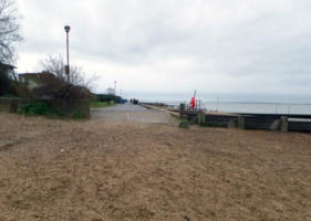
Jan
2015
Start
of
Chalkwell
Esplanade,
beach
by Chalkwell Railway Station
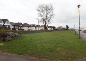
Jan
2015
Mid
1990s
area
where
putting
green was laid, now an open green space
One
of
the
most
controversial
developments
is
the
Nirvana
apartments.
The
first
planning
application
for
the
Nirvana
apartment
block
was
submitted
in
2003,
after
a
lengthy
planning
process
the
plans
were
passed
and
construction
started
in
March
2007.
When
the
excavation
works
started
500
concrete
piles
were
piled
deep
into
the
ground,
the
block
then
steadily
rose
up
to
ten
stories
high.
The
initial
build
of
the
structure
was
rapid
with
a
topping
out
ceremony
in
September
2008,
three
months
earlier
than
originally
predicted.
The
term
“topping
out”
is
a
ceremony
held
when
the
last
beam
is
placed
at
the
top
of
a
building,
and
not
the
completion
of
the entire build. The construction was carried out by Allied Construction, of Rayleigh, who used local contractors.
Nirvana apartments replaced the Grosvenor Care Home, the building is next door Admirals Place apartment block.
When
the
recession
hit
the
UK
in
2009
the
construction
of
the
apartment
block
slowed
and
then
stopped.
After
a
year
of
being
wrapped
in
scaffolding
and
sheet
plastic
with
no
work
being
undertaken
work
resumed
in
2010
with
a
proposed
completion date of spring 2011.
In
August
2011
the
scaffolding
was
finally
removed,
finally
revealing
the
striking
building
beneath,
the
wood,
white
concrete
and
brightly
painted
balconies,
the
Nirvana
was
the
tallest
building
on
the
seafront.
The
new
45
apartment
development
includes
a
range
of
two
and
three
bed
room
flats,
the
block
included
a
communal
decorative
infinity
pool
and,
in
addition
to
spectacular
sea
views,
the
apartments
have
underfloor
heating,
kitchens
installed
by
Hadleigh-
based
kitchen
designer
Paul
Newman
with
Porcelanosa
tiles
on
the
floors
and
walls,
a
54
space
underground
car
park,
on-site
fitness
centre
with
private
swimming pool.
The
new
apartments
were
set
to
go
on
the
market
for
£400,000
to
£1million.
With
a
rumoured
£2.5million
for
the
penthouse.
However,
the
new
flats
were
soon
to
be
dogged
by
further
delays
with
issues
over
access.
In
February
2013
a
land
owner
pointed
out
that
the
access
to
the
Nirvarna
Apartments
would
need
to
cross
a
100
yard
long
six
inch
wide
strip
of
land
between
the
Nirvarna
and
the
neighbouring
Bellway
Court
and
that
they
had
not
given
permission
for
any
access
to
cross
it.
All
sales
were
put
on
hold
until
a
solution
could
be
found.
In
November
2013
nine
months
after
the
land
issue
started
the
flats
had
still
not
been
put
on
the
market.
In
January
2015
it
was
announced
that
former
tennis
ace
David
Lloyd
who
was
had
moved
into
property
development
and
leisure
centres
was
reported
to
be
in
the
process
of
buying
the
Nirvana,
however
the
sale
never
happened
instead
the
St
Helier,
Jersey
based
Nirvana Investments Limited were listed as the new owners.
The
sun
(and
rain!)
shelter
located
at
the
bottom
of
Chalkwell
Avenue.
In
2010
the
rear
wall
was
moved
forward
to
provide
space
for
new
public
toilets,
this
was
necessary
because
others
further
along
the
Esplanade
were
deemed
too
old
and
did not have easy disabled access.
The
slopes
were
built
at
the
same
time
as
the
Esplanade
apart
for
gaining
access
to
the
beach
from
the
promenade,
these
were
also
used
by
boat
owners
who
dragged
their
rowing
boats/small
sailing
boats
out
of
the
water
and
onto
the
promenade
for
winter
maintenance.
Disabled
access
was
always
a
problem,
Southend
Council
installed
several
disabled
access
points
that
include
steps
and
a
gentle
sloping
ramp
with
handrails
on
both
sides,
these
lead
down
to
a
decked area on the beach.
During
1925
the
local
Corporation
(Council)
laid
a
green
for
bowls
and
an
miniature
golf
course,
the
lumpy
bumpy
course
proved
popular during the summer season and for 6d you were lent a ball and a putter, today the site is part of the rock garden.
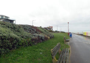
Jan
2015
The
site
of
the
1925
miniature
golf
course, the now a rock garden with footpath
Many
of
the
Edwardian
and
Victorian
houses
still
exist
on
the
north
side
of
Chalkwell
Esplanade,
most
of
these
started
as
houses
before
being
converted
into
guest
houses,
with
changing
times
reverted
back
to
private
dwellings,
many
have
had
additions
and
gained
double
glazing,
some
have
been
replaced
by
more
modern
houses,
whilst
others
have
made
way
for
much
larger
exclusive developments.

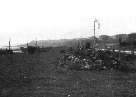
1909 Chalkwell Esplanade & Gardens
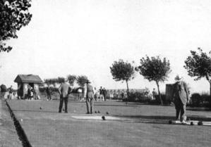
1928 Chalkwell Bowls Green
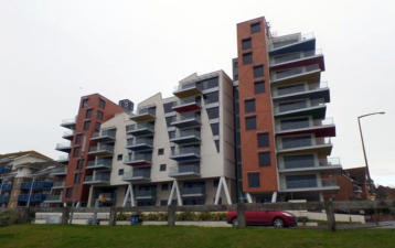
Jan 2015 The landmark Nirvana apartment block
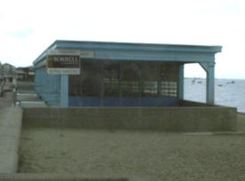
Jan 2015 The Toulouse Restaurant
With
the
new
esplanade
taking
shape
the
influential
Westcliff
Ratepayers
Association
raised
complaints
about
the
poor
and
deteriorating
condition
of
Occupation
Road
(now
known
as
Shorefield
Road)
leading
off
Station
Road.
A
new
road
linking
the
newly
laid
Westcliff
Esplanade
to
Shorefield
Road
was
proposed,
which
would
also
provide
a
second
access
route
to
the
recently
built
Palmeira
Towers
(built
between
1902-1903).
The
land
immediately
in
front
of
the
Palmeira
Towers
had
a
narrow
road
with
an
earth
bank
leading
down
to
Western
Esplanade,
the
reconstruction
plans
also
included
a
new
wider
road
to
access
Station
Road,
this
would
be
supported
by
17
arches
under
the
road,
it
was
proposed
that
the
arches
could
be
rented
out
at
£211
per
year
for
such
uses
as
boat
houses
or
shops
with
another converted into public toilets.
Work
started
in
January
1905,
with
applications
opening
for
lettings
in
May
1905,
it
was
April
1906
when
the
first
lettings
were
agreed,
the
newly
built
arches
was
given
the name Palmeira Parade.
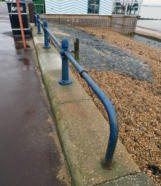
Jan 2015 Old railings
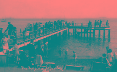
Postcard
view
of
The
Westcliff
Jetty
was
a
short
wooden
jetty,
popular for fishing, demolished in the 1980s
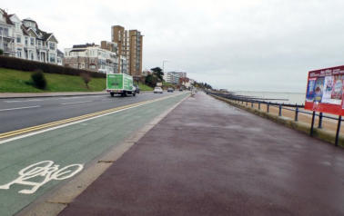
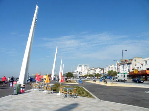
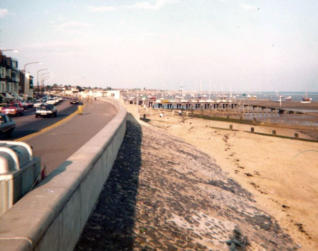
2015 The Westcliff Esplanade
Access
to
the
beach
is
via
the
original
steps,
the
structures
(groynes)
built
perpendicular
to
the
shoreline
help
cut
down
on
long
shore
drift.
They
trap
sand
which
helps
build
up
the
beach
naturally
from
the
sandbanks
out
in
the
estuary.
This
helps
cut
down
the
amount
of
beach
management,
however,
whilst
they
help
the
area
they
are
installed
they
do
have
an
adverse
effect
of
depriving
other
areas
of
the
sand,
leaving
those
areas
with
smaller
beaches.
This
can
result
in
erosion
to
more
susceptible
areas
or
undermine
defences
as
the
tides
wash
sand
away
from
the
foundations
of
sea
walls,
these
areas
need
to
have
their
sand
topped
up,
by
either
importing
in
by
road
or
as
in
Southend's
case
replacing
sand
dredged
from
the
Thames
Estuary
sandbanks
which
is
pumped
ashore
in a sand & water mix.
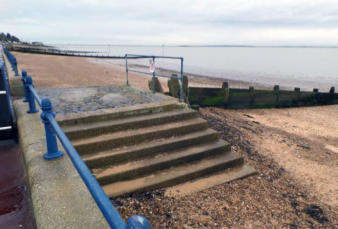
Jan
2015
The
steps
and
groynes
on
Westcliff
Esplanade
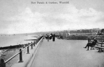
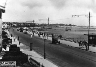
June 1925 Postcard view of the New Parade at Westcliff
The
1930s
was
an
era
when
hoteliers
would
deter
guests
from
staying
in
the
hotel
during
the
day,
as
this
time
would
be
used
to
carry
out
cleaning
and
other
works
in
the
hotel.
With
this
in
mind
the
Council
undertook
a
building
programme
of
improving
the
esplanades
further,
this
saw
the
re-landscaping
of
the
gardens,
included
the
building
of
sun
(and
rain)
shelters,
one
of
these
is
the
horseshoe
shelter
on
Western
Esplanade
(below
Clifton
Drive).
The
shelter
was
constructed
from
red
brick
with
stone
detailing
and
metal
windows,
as
well
as
providing
shelter
the
structure
acts
as
a
retaining
wall
to
the
cliffs
behind.
The
shelter
proved
popular
with
tourists,
but
with
the
decline
of
British
seaside
holidays,
the
shelters
became
neglected.
The
Council
elected
to
see
if
they
could
lease
structure
out
to
a
private
developer
as
a
café/restaurant,
this
would
work
as
a
way
of
restoring
the
building
and
generate
an
income
from it. The lease was signed and a £300,000 restoration commenced on the 10th November 2014.
The restored sun shelter now the Oyster Creek
2012 The Horseshoe sun shelter
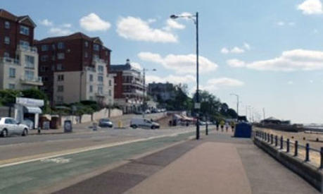
Two
views
of
Westcliff
Esplanade
looking
towards
Shorefield
Road,
taken
92
years
apart,
the
first
in
1922,
the
second
in
2014,
many
of
the
buildings have changed
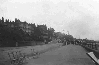
Postcard
view
of
the
then
recently
completed
Esplanade and arches
Jan 2015 Shelter, bottom of Chalkwell Avenue
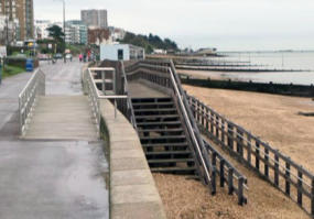
Jan
2015
One
of
the
disabled
access
points
on
Chalkwell Esplanade
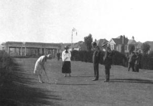
1928 Chalkwell Putting Green
Postcard
view
of
Chalkwell
Esplanade
with
period
houses
Chalkwell Esplanade
Chalkwell Station to Grosvenor Road
The
Chalkwell
Hall
Syndicate
had
recently
bought
the
Chalkwell
Hall
Estate,
in
preparation
for
a
high
class
residential
building
scheme,
after
protracted
talks
an
agreement
was
signed
in
August
1901
that
would
see
the
syndicate
sell
Chalkwell
Hall,
and
26
acres
of
land
to
create
a
public
park.
In
return
the
Borough
Corporation
would
construct
a
seawall
and
esplanade
with
roadway
with
grass
plots
along
the
sea
frontage
of
the
estates
frontage.
To
accommodate
the
new
facilities
the
Syndicate
would
sign
over
the
estates
foreshore
plus
a
strip
of
land
up
to
130ft
wide
from
Grosvenor
Road
heading
west
1050yards.
The
syndicate
also
agreed
to
pay
£8000
over
a
ten
year
period towards the cost and maintenance of the wall and esplanade.
Work
started
on
the
Chalkwell
section
in
1903
and
completed
March
1905
at
a
cost
of
£22914.
At
the
same
time
as
the
Chalkwell
plans
were
being
processed
the
Westcliff
section
was
also
being
prepared for widening.
The
area
of
beach
immediately
outside
Chalkwell
railway
station
was
owned
by
the
Midland
Railway
Company,
in
1909
a
20
year
lease
was
signed
with
Mr
Arthur
Joscelyne
Sr,
who
erected
tents
and
a
stage
for
public
entertainments,
the
lease
was
passed
on
through
the
family.
At
some
point the land ownership passed to Southend Council, who in 1948, refused to renew the lease.
A
green
space
was
laid
for
picnicking
and
for
fairs
to
be
hosted,
this
site
was
made
into
a
putting
green
in
the
mid-1990s
but
did
not
last
long
before
it
once
again
became
a
green
space,
today
whilst a green space it is set aside for windsurfers to rig their boards and sails.
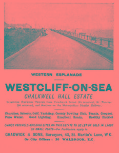
Advert
from
the
cover
of
a
programme
for
the
Vaudeville
Theatre
in
London
extolling
the
benefits
of
the
Chalkwell
Hall
Estate
March 1914
2012
Seating
inside
the
Horseshoe
sun
shelter
Western Esplanade
Piccadilly Steps (Holland Road) to the Pier
The
plans
to
widen
mile
long
stretch
of
Western
Esplanade
between
Palmeira
Parade
and
the
Pier
were
originally
submitted
in
December 1909, amendments were ordered and the new plans were submitted for approval in April 1910.
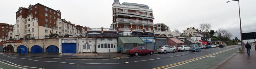
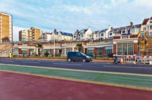
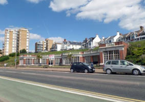
Palmeira
Parade
is
better
known
as
"The
Arches"
the
historic
structure
marks
the
start
(or
end)
of
Western
Esplanade
or
is
it
the
start
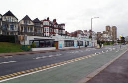
or end of Westcliff Esplanade or both...! They are occupied by the popular Westcliff Caf
é
s
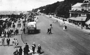
Western
Esplanade
on
30th
June
1922,
boats
are
laid
up
on
the
edge
of
the
road,
whilst
Shorefield
Road
is
in
the
foreground,
one
of
the
bastions
is
to
the
centre
left
of
the
photo
The
same
boat
as
in
the
image
seen
above
here
in
1932
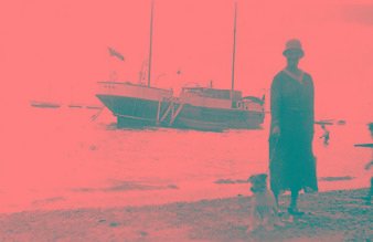
was part of the Westcliff Yacht Club
The
amended
plans
were
to
provide
a
new
seawall
backfilled
and
levelled
to
provide
a
dual
carriageway
with
promenading
footpaths
either
side
of
the
road,
the
opposite
lanes
of
traffic
were
to
be
divided
by
a
central
reservation
of
lawns
and
flowerbeds.
The
works
were
to
be
undertaken
in
stages
of
¼mile
the
first
being
Palmeira
Parade
to
the
Nore
Yacht
Clubhouse,
the
tender
for
the
work
was
signed on 20th December 1910 with work starting shortly after.
Postcard
view
of
Western
Esplanade
before
the
widening,
no
cars
just
a
space
for
promenading,
boats
pulled
out
of
the
water
for
maintenance,
at
the
time
of
this
depiction
nude
swimming
was
still
popular
but
modesty
was
still
paramount
so
the
bathing
machines
were
used
to
strip
off
in
and
wheeled
into
the
sea
so
that
you
could
slip
into
the
water
unseen
and
then climb back in to get dressed
A
later
postcard
with
the
widened
promenade
open
to
cars
as
well
as
walkers,
the
central
reservation
was
originally
full
of
trees
and
shrubs
but
as
the
town
grew
these
were
removed
to
enable
boats
to
be
taken
out
of
the
water
during
the
winter
months,
eventually the area became the car parking we have today
A
1959
view
of
Western
Esplanade,
at
the
time
the
photo
was
taken
the
car
parking
space
had
yet
to
be
laid
on the central reservation
The
proposals
also
included
two
seating
platforms
to
be
constructed,
these
would
jut
out
from
the
new
promenade
so
that
the
walkway
could
remain
free
of
deckchairs.
The
first
of
these
platforms
was
built
opposite
Shorefield
Road,
it
was
constructed
by
building
a
right
angle
into
the
seawall,
a
new
wall
was
erected
leading
56ft
out
from
the
promenade
before
another
90degree
turn
to
follow
the
promenade
for
158ft
before
a
third
90degree
turn
lead
back
to
the
promenade,
these
areas
were
then
backfilled
before
being
levelled
off.
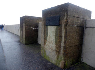
This
Bastion
has
seen
little
in
the
way
of
development,
the
kiosk
has
been
the
most
prominent feature built on it, the kiosk has been rebuilt a number of times.
Jan
2015
The
first
Bastion
is
virtually
opposite
the
Arches
&
was popular with deckchair users in the summer
Aug
2015
The
first
Bastion
photographed
from
Shorefields
Road,
the
two
small
patches
of
grass
are
original to the construction
The
second
was
built
about
halfway
between
the
first
and
the
Pier,
this
one
was
built
larger
with
it
jutting
88ft
out
in
to
the
Estuary
stretching
333ft
across,
they
became known as the Bastions.
The
larger
of
the
two
Bastions
has
developed
much
more
than
the
other,
it
became
the
chosen
site
for
an
open
air
swimming
pool
in
1912
after
the
opening
of
the
Warrior
Square
pool
in
October
1969
the
site
became
a
Dolphinarium,
the
venture
did
not
last
long
and
it
was
sold
to
the
Brent
Walker
Group
who
built
the
Westcliff
Leisure Centre, this later became the Westcliff Casino.
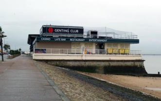
Jan
2015
The
second
of
the
Bastions
is
the
Genting
Club casino
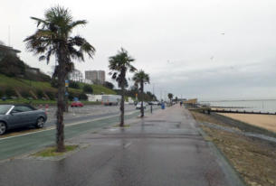
Jan
2015
Palm
trees
add
a
flavour
of
hotter
climes to Western Esplanade
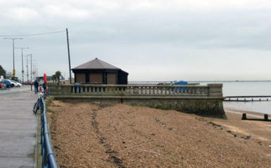
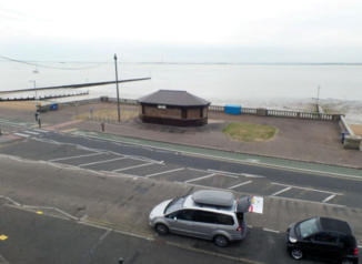
Site before the new lagoon was built
Postcard
view
of
the
area
immediately
outside
the
Pier
Hill
complex
of
1898,
the
widening
scheme
had
not reached this section yet
Western Esplanade from the Pier, look, no crossings!

Postcard
view
of
marine
Parade
before
the
land
reclamation
scheme
was
put
in,
this
area
would
become
home
to
the
Golden Hind and Adventure Island in the decades to come
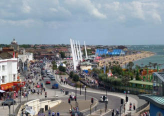
Modern
day
view
of
the
City
Beach
(Marine
Parade)
the
new
illumination
towers,
the
Kursaal
Dome
and
the
pitched
roofs
of
the
Sealife
Adventure
can
all
clearly be seen
Marine
Parade
was
also
home
to
the
Golden
Hind
pirate
ship
attraction,
a
replica
of
Sir
Francis
Drakes
famous
ship,
this
was
replaced by the Queen Anne's Revenge that too has now been replaced by a new indoor children's play area.
Works
on
the
seafront
included
removing
the
dual
carriageway
and
replacing
it
with
a
single
lane
in
each
direction,
this
enabled
the
public
footpaths
to
be
greatly
increased
in
size.
The
underground
public
toilets
were
filled
in
and
replaced
with
ground
level
cubicles.
A
new
raised
public
exhibition
space
was
built
on
top
of
the
former
men
toilets,
the
changes
also
included
repaving
of
the
entire stretch between the Pier and the Kursaal and a new fountain.
The City Beach promenade enables alfresco dining on those sunny days
Undated
photo
of
Eastern
Esplanade
looking
east
towards Thorpe Bay
The
old
toilet
block
has
been
left
locked
up
for
several
years
plans
to
convert
it
into
a
bin
store
were rejected in 2014
The
only
two
remaining
blocks
can
be
found
on
Eastern
Esplanade
opposite
the
old
gas
works
site
now the Premier Inn hotel
The
seawall,
this
1981
view
shows
how
low
the
sand
had
become
over
the
decades
of
long
shore
drift,
the
replenishment
of
the
beach
has
seen
the
level
of
the
sand
raised
up
to
that
of
the
bottom
of
the vertical seawall
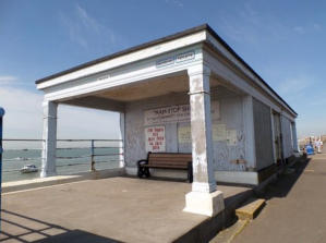

The old Tram Stop Shelter
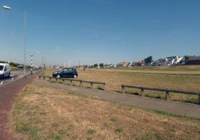
One
of
the
large
open
greens
on
Thorpe
Esplanade
now
acts
as
the
Thorpe
Esplanade
Car Park
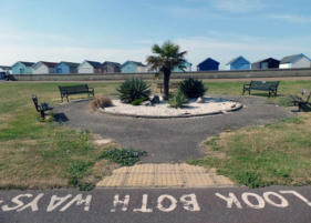
More
formal
seating
on
Thorpe
Esplanade
surrounding planted garden area
The Promenade at Shoebury Common
The sun shelter on Eastern Esplanade before its renovation and after as Ocean Beach


Website Info:

Southend-on-Sea’s No 1 History Website! Documenting The Town & The Townspeople
Now Incorporating The Sea Of Change Website


SOUTHEND CITY
Chalkwell ▪ Eastwood ▪ Leigh-on-Sea ▪ Prittlewell ▪ Shoeburyness ▪ Southchurch ▪ Thorpe Bay ▪ Westcliff-on-Sea


